St. Paul Lutheran Church (Marchwell) and Cemetery


The Story
The St. Paul's Lutheran Church - Missouri synod originated back in 1914. It was at this time that Rev. P. Weigner, who served Hoffenthal (1914-1923) began to hold services in the homes of German Lutheran people who were living in and around Marchwell.
On January 6, 1918, a congregation was formed and the "little free church" was purchased from the sum of ninety dollars. This church was on the south side of number 14 highway. The highway came from the north and turned east through the main street of Marchwell to Russell. The church was two hundred yards from the west part of town.
The first elders were: George Lowenberger Jr., Heinrich Mueller, and George Schepp. The treasurer was Julius Kriewaldt.
Reverend Weigner constructed the altar and pulpit for his "little" church at his own expense.
In July 1955 at a special meeting, it was decided to put a tender in for one thousand dollars for the old Marchwell School building. The tender was accepted and renovations began at that time. The "little free church" was then sold to Charles Geohring who used it for his house. The membership count at this time was fifty-eight souls and forty communicants.
In January 1969, the church was closed and the property was sold to Stan Yont who used it for a garage. The pews and the bell were donated to a congregation in Margo, Saskatchewan. The hymnals were donated to Jackfish Lutheran Camp, and the communion ware to Christ Lutheran in Langenburg. The organ was sold to Frank Mehringer.
In 1918, George Schepp donated one acre of land for the cemetery on SW 23-21-30, two hundred yards north of SW corner of Section 23.This cemetery is looked after by Christ Lutheran Church in Langenburg. It has a new fence in the front and is well taken care of, and is still used for burials.
Finding the Cemetery
GPS: 50.81648,-101.55504
Driving Directions
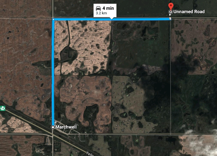
Drive 1 mile north of Marchwell.
Turn east and drive 1 mile.
Cemetery is on the North side of the road, but slightly off the road. A short, but accessible, trail marks the entrance.
The map below is a screenshot that shows directions to the cemetery. To view the interactive map, click here.


